


How to get to Tayrona Natural Park
Routes and access
Discover the entrance routes to Tayrona National Park, the beaches connected to each one, and the type of access available (car, bus, or hiking). Up-to-date information and important recommendations.
Location and Entrances to Tayrona National Park
Tayrona National Natural Park is located in the Caribbean region, approximately 34 kilometers east of Santa Marta. The park stretches from the mountains of the Sierra Nevada down to the sea, creating a unique ecosystem where tropical rainforest, pristine beaches, mangroves, and coral reefs come together.
Entrances to Tayrona National Park
From Senda Hotels, you can reach the park’s main entrances in just a few minutes, making it a strategic starting point for your experience. Below, you’ll find a complete guide to understanding how to enter, from where, and which trails you can explore based on your time, physical condition, and travel preferences.

El Zaino Entrance
Location: 32 km from the city of Santa Marta along the Troncal del Caribe highway toward La Guajira. Just 5 minutes from our Senda hotels.
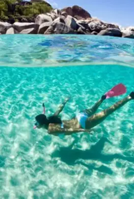
Access to: From this entrance you can reach beaches such as Castilletes, Cañaveral, Arrecifes, Arenilla, La Piscina, Cabo San Juan, and Pueblito.
Type of access: Hiking from the visitor center. Internal transportation is also available to Cañaveral.
Ideal for: First-time visitors, families, moderate hikers, and scenic routes.
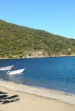
Neguanje Entrance
Location: 12 km from the city of Santa Marta along the Troncal del Caribe highway toward La Guajira.
Access to: From this entrance you can reach beaches such as Chengue and Gairaca on foot, and by boat to others like Playa Cristal (7 minutes), Playa Cinto (20 minutes), and Wachaquita (30 minutes).
Type of access: Vehicle access (up to the Neguanje parking area).
Ideal for: Families, older adults, photography, and snorkeling.
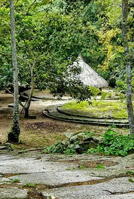
Pueblito Chairama Entrance
Location: 32 km from the city and just 2 km before reaching the El Zaino entrance; it is known as the Calabazo entrance.
Access to: A 3-hour hike leads to the ruins. Continuing along the trail, you can reach Cabo San Juan and Playa Brava.
Type of access: Challenging hike, a route that requires greater physical effort.
Ideal for: Adventurous travelers in good physical condition seeking fewer crowds.
Bahia Concha Entrance
Location: The entrance closest to Santa Marta (30 minutes by car). Access is through the Bastidas neighborhood via an unpaved road that leads to the bay.
Access to: Bahía Concha.
Type of access: Road access directly to the beach, the shortest and easiest route.
Ideal for: Quick visits, families with children, and older adults.
EXPERIENCES